 As a publisher focusing on the professional IT sector, I ask myself this question a lot: What does the technology add? Is this new tool or release measurably different from the others? Will it enable users to create products faster, less expensively, with more useful features—or all of the above?
I found myself asking the same question when I recently read about this project, The 21 Steps, by Charles Cumming, which is part of Penguin’s We Tell Stories initiative. In The 21 Steps, Cumming uses Google’s satellite imagery to help tell the story. Different? Yes. Functional use of the technology to enhance the reading experience? I’m not so sure.
Lasted just three chapters…
![]() To be fair, I only got through the first three chapters before I lost interest. Perhaps it’s because I’m not into fiction, but I found the text and imagery integration lacking as well. I didn’t see the benefit to having the animated movements on the satellite images. I also got pretty tired of clicking again and again, just to read the next sentence or two. In short, if technology is added to the formula for something like this, I feel it should improve the overall experience; in this case, it seemed to weigh it down.
To be fair, I only got through the first three chapters before I lost interest. Perhaps it’s because I’m not into fiction, but I found the text and imagery integration lacking as well. I didn’t see the benefit to having the animated movements on the satellite images. I also got pretty tired of clicking again and again, just to read the next sentence or two. In short, if technology is added to the formula for something like this, I feel it should improve the overall experience; in this case, it seemed to weigh it down.
I’m also not the sort of person who thinks in terms of satellite views. I’m more of a street level guy, and I suspect I’m not alone. After all, we see and experience things from a street-view view, not an overhead one, so it forces you to constantly adjust your perspective as you’re reading through the screens.
…but love Penguin’s experimentation
Before anyone jumps down my throat on this, please realize that I absolutely love the fact that Penguin is experimenting with technology on this project. If I published into the fiction area, I’d be jealous that I didn’t think of this approach. The lessons that can be learned from the pioneers like Penguin will help benefit everyone in the long run.
For example, as I ran through those chapters of The 21 Steps, I started to think about other applications for a narrative-map mashup. Think about travel guides for a moment. A walking tour of a city with travel guide content spliced into satellite map displays would be cool. Switching to street-level view instead of satellite probably makes it better. Offering the capability to flip between both is better yet.
More community, please
I’d also like to see more content goodies sprinkled throughout, and perhaps this is where community content could come into play. Maybe the tour features great pictures from previous visitors or recommendations they have for future visitors. Let them be ranked by the community itself so that only the top show up as push-pins on the screen.
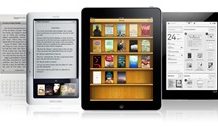
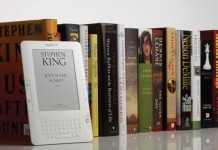
The device has to be considered here as well. If I’m doing the tourist thing it’s unlikely that I’m carrying around something larger than a cell phone or Blackberry. You can’t design this for a computer when it’s being used on a display that’s much smaller. This is where the Kindle might evolve into something highly useful. Imagine a next-generation Kindle with a color display. The Kindle’s Whispernet technology would enable cellphone-like connectivity with a larger, but still portable display.
So again, I applaud Penguin’s efforts here, and although I’m not convinced this is anything more than technology for technology’s sake, there’s much to be learned from the experiment itself.


