From a D.R. Map Collection Blog Post:
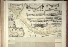
1,596 new maps and images have been added to the David Rumsey Map Collection, bringing the online collection to 30,599 maps and images. Included in this addition is Bowles’ 1733 Geography Epitomiz’d, an early example of information visualization; Abraham Bradley’s 1805 Post Road Map of the United States; Aaron Arrowsmith’s General Atlas of 1817; a group of U.S. Mexican War broadsides and maps; Mitchell’s 1855 Universal Atlas; a group of 214 individual maps, charts, broadsides, ephemera, and manuscript maps, several of which are listed separately below; Sonnenschein and Allen’s 1880 3D Royal Relief Atlas; Erwin Raisz’ 1944 Atlas of Global Geography and 1964 Atlas of Florida; and Richard Harrison’s important 1944 Fortune Atlas for World Strategy. All titles may be found by clicking on the View links or images below. Or click here to view all 1,596 new maps and images.
Read the Complete Blog Post (with Highlights)
BTW: The Rumsey Collection is Included in the New (and Wonderful) OldMaps.org Database
A must see (and use).
[Via INFOdocket]


